KAIST
BREAKTHROUGHS
Research Webzine of the KAIST College of Engineering since 2014
Spring 2025 Vol. 24Real-time path planning for UAVs to cooperatively localize information sources
Real-time path planning for UAVs to cooperatively localize information sources
A key technology that enables a team of unmanned aerial vehicles (UAVs) to cooperatively observe objects of interest and localize the information source is developed. The technology features a distributed real-time planning algorithm that designs informative paths for the team of UAV-based sensor platforms. Flight tests with multiple fixed-wing UAVs performed in collaboration with University of Colorado Boulder have verified the effectiveness of this new technology.
Article | Spring 2018
What can be done using unmanned aerial vehicles (UAVs): filming spectacle scenery in a TV program, delivering items you have bought on the Internet, or performing secret defense operations? One potential use would be to identify the location and motion of information sources (e.g., beacons, RFID tags, and chemical plume sources) in the process of disaster response or environmental monitoring.
An international collaborative work by Prof. Han-Lim Choi in the Dept. of Aerospace Engineering at KAIST and Prof. Eric Frew in the Dept. of Aerospace Engineering Sciences at the University of Colorado Boulder has demonstrated core technology for this type of operation of UAVs. They developed a set of distributed algorithms that effectively design optimized paths for multiple cooperative UAVs and also update the planned paths on the fly upon dynamic changes in the environment and the mission progresses. They also tested and verified their algorithms through a sequence of flight tests performed in the Pawnee Grasslands, Colorado, USA, on Aug. 14 – 22.
Path design/planning of UAVs for this type of information gathering mission is much more complicated than for a typical operation because the amount/quality of information gathered along the trajectory needs to be taken into account in addition to the path length, energy consumption, and obstacle avoidance. This additional piece of information significantly increases the dimension of decision space and also requires coupling between the control problem and the estimation problem. The research team proposed a method that effectively transforms the original large-scale optimization problem into a set of smaller subproblems that represent problems for a single information source, and then iterative solve the subproblems via a consensus-like sharing procedure called the alternating direction method of multipliers (ADMM). In particular, to efficiently quantify the propagation of uncertainty in the information sources, a linearization-based efficient technique, known as iterative linear quadratic Gaussian (iLQG), was utilized.
For the flight tests, three fixed-wing UAVs equipped with custom-built directional radio frequency (RF) antenna were used; the goal of mission was to localize the custom RF beacons. To process the sensor data, particle filtering was used to estimate the motion of the information sources. The output of this particle filter is used as an input data for the aforementioned planning algorithm to generate the most informative UAV paths over a specified future horizon. Figures 1 and 2 depict the overall mission architecture for the flight tests and the transmitter and receivers used in the experiments. Figure 3 illustrates a sample case of planned trajectories for the cooperative mission of localizing three targets with 3 UAVs. The cooperative hand-over of the target can particularly be noticed.


News article related to this international collaborative research:
https://www.denverpost.com/2017/09/11/cu-boulder-drone-technology-hikers-wildlife/
http://insideunmannedsystems.com/working-together
Most Popular

When and why do graph neural networks become powerful?
Read more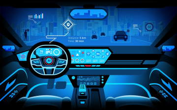
Smart Warnings: LLM-enabled personalized driver assistance
Read more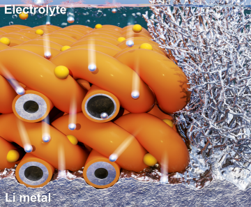
Extending the lifespan of next-generation lithium metal batteries with water
Read more
Professor Ki-Uk Kyung’s research team develops soft shape-morphing actuator capable of rapid 3D transformations
Read more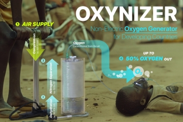
Oxynizer: Non-electric oxygen generator for developing countries
Read more